
What is geomarketing?
Most business decisions have an address in them. Geomarketing is the discipline that puts that address on a map and measures what is around it.
Geomarketing is the use of maps and location data to make commercial decisions: where to open a store, who lives within reach of it, where competitors already are and how far customers will travel. It joins population and spending statistics to the road network and to business locations, so a choice about place rests on numbers.
This is the overview. How geomarketing differs from location intelligence and GIS has its own guide, location intelligence vs geomarketing.
Where does geomarketing come from?
The ideas are older than computers. Economists and geographers spent the twentieth century asking why shops cluster where they do and how far people travel to them.
- 1931
William J. Reilly
The law of retail gravitation: a town draws shoppers in proportion to its size and in inverse proportion to the square of the distance.
- 1933
Walter Christaller
Central place theory: towns form a hierarchy, and each kind of shop needs a minimum population within reach to survive.
- 1949
Paul D. Converse
The breaking point between two towns: the line where shoppers are equally likely to go one way or the other.
- 1963–64
David L. Huff
Probabilities instead of borders: every home has a chance of choosing each store, depending on its size and on travel time.
- Today
Geographic information systems
The same models run on the road network, address by address, with population and spending statistics already attached.
A review of supermarket location research groups these ideas into four families: central places, spatial interaction, land value and the tendency of competitors to cluster. Of the four, spatial interaction models — the line that runs from Reilly to Huff — are the ones businesses use most.
Sources: Reilly (1931), The Law of Retail Gravitation; Christaller (1933, transl. 1966), Central Places in Southern Germany; Converse (1949), Journal of Marketing 14(3); Huff (1963), Land Economics 39(1) and (1964), Journal of Marketing 28(3); Baviera-Puig, Buitrago-Vera and Escriba-Perez (2016), “Geomarketing models in supermarket location strategies”, Journal of Business Economics and Management 17(6).
What questions does geomarketing answer?
Each question has its own method. The guides below explain them step by step.
| The question | The method | Guide |
|---|---|---|
| Where should I open? | Demand, supply and opportunity for a sector, mapped cell by cell | Retail site selection |
| Who am I up against here? | Competitors of the sector within a drive time, their density and estimated sales | Competitor analysis |
| Who can reach my store? | Drive-time or walk-time catchments on the road network | Catchment area analysis |
| Who lives around this address? | Residents, ages, income, spending and housing compared with the surroundings | Demographic analysis |
| Are my stores competing with each other? | Overlap between the catchments of the same network | Cannibalisation analysis |
| Is the area fairly split between my reps? | Territories balanced on clients, prospects or residents | Sales territory mapping |
What data does geomarketing use in Australia?
Four layers do most of the work. The first is the statistical geography of the ABS: since July 2026 (Edition 4) Australia is divided into 374,916 mesh blocks, 63,484 SA1 areas, 2,570 SA2 and 107 SA4 regions, alongside 566 councils and 2,644 postal areas.
On that geography sit the people: the yearly population estimate and the census every five years. The third layer is money — income from tax data and household spending from the national accounts. The fourth is the map of businesses and the road network, which turns distance into travel time.
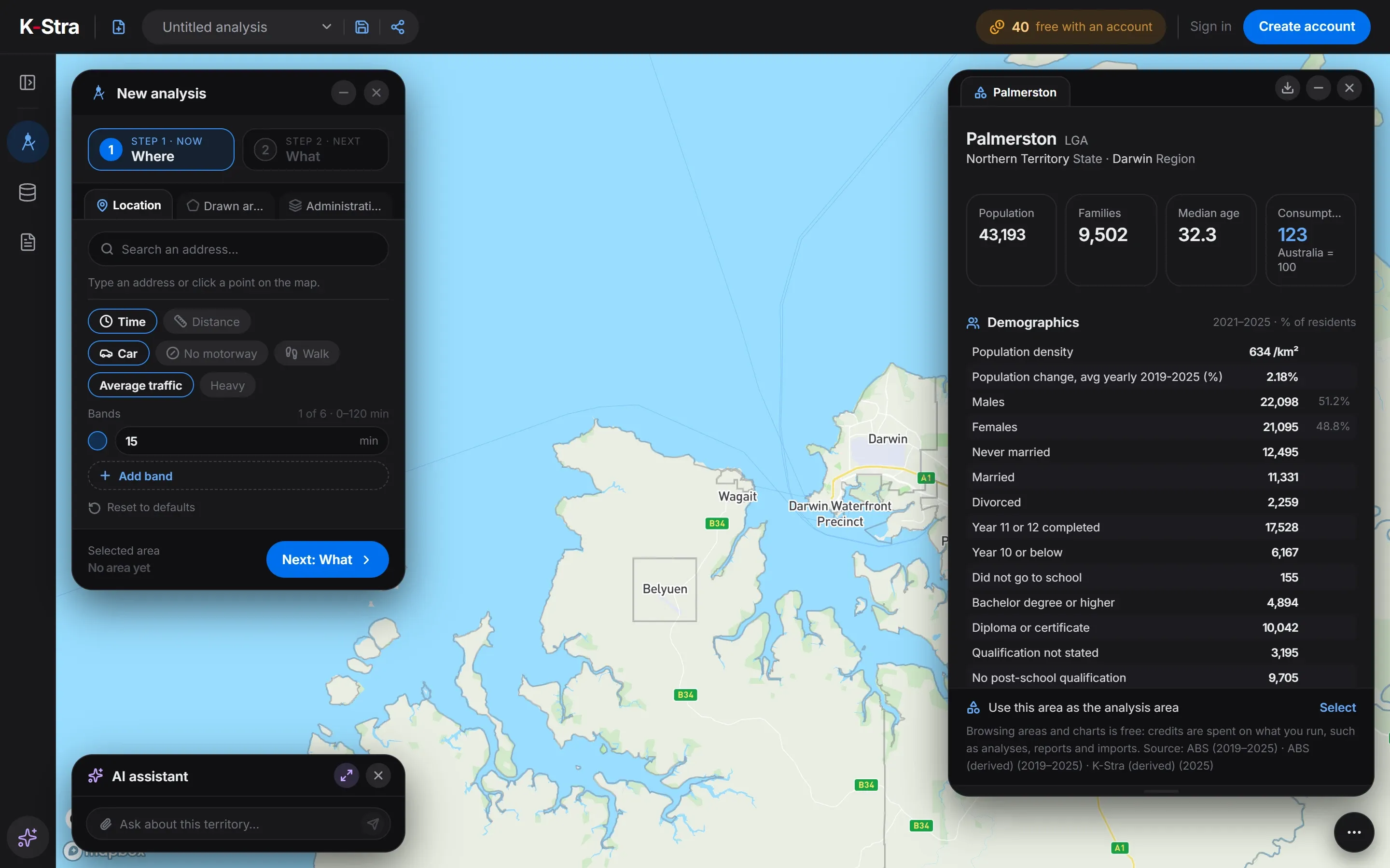
Joined together, they answer questions no single source can. The dashboard opposite is free in K-Stra for any council: 43,193 residents in the City of Palmerston, near Darwin, a median age of 32.3 and a consumption index of 123, where Australia is 100.
Sources: ABS, ASGS Edition 4, July 2026 and non-ABS structures. K-Stra still uses the SA1–SA4 areas of Edition 3 (2021): 61,844 SA1, 2,472 SA2 and 107 SA4 areas.
 No account needed
How is geomarketing different from a GIS?
A geographic information system is a general toolbox: it draws, stores and analyses anything with coordinates, from pipelines to bushfire zones. It expects you to bring the data, clean it and choose the method, which is why traditional GIS work sits with specialists.
Geomarketing applies a small part of that toolbox to commercial questions, with the data already loaded and the methods chosen. The trade-off is focus: a geomarketing tool will not plan a sewer, but it answers “who lives within ten minutes of this shop?” in seconds.
What else do people ask about geomarketing?
Is geomarketing only for shops?
No. Any business whose customers come to a place, or whose staff go to customers, faces the same questions: gyms, clinics, childcare centres, car dealers, banks, franchisors and field sales teams. Councils and health services use the same methods to plan facilities.
Do I need GIS skills to use geomarketing?
Not with a tool built for it: the data and the methods come ready, so the work starts from an address and a question. Location intelligence vs geomarketing explains what GIS software adds and when you need it.
What is the difference between geomarketing and location intelligence?
Geomarketing is the commercial branch of location intelligence, which covers any use of location data. The full comparison, with GIS, is in location intelligence vs geomarketing.
Does geomarketing use personal data?
It does not need to. The public statistics behind it are published for areas, never for people, and a store decision rarely needs more. When a business adds its own customer file, it can be reduced to postcodes or counts before it is uploaded.
How accurate is geomarketing?
As accurate as its inputs and its question. Population counts are official estimates; spending and opportunity are models, good for comparing places in the same sector and region rather than for promising a figure. A visit to the shortlisted sites remains part of the method.
Pick a council,
read its numbers.
Open the map, click the name of any council and see who lives there. No account needed to explore.
Open the app — free to exploreArea dashboards are free