
Which areas and maps does K-Stra use for Australia?
Every figure in K-Stra sits on a map: official areas for reporting, single addresses for counting, and roads for travel times.
K-Stra divides Australia into nine ABS administrative levels, from the whole country down to 61,844 SA1 areas, and below them into 14.5 million address points. Statistical areas follow the 2021 edition of the ABS geography and councils the 2025 one. A road network of 12 October 2026 gives travel times by car and on foot.
Which administrative levels can I analyse?
| ABS code | Level | Areas in K-Stra | Boundaries | Example |
|---|---|---|---|---|
| AUS | Country | 1 | ASGS Ed. 3 | Australia |
| STE | States and territories | 10 | 2021 | New South Wales |
| SA4 | Statistical Area Level 4 | 107 | 2021 | Sydney – Eastern Suburbs |
| LGA | Local government areas | 566 | 2025 | Woollahra |
| POA | Postcodes | 2,643 | 2021 | 2028 |
| SA3 | Statistical Area Level 3 | 358 | 2021 | Eastern Suburbs – North |
| SAL | Suburbs and localities | 15,352 | 2021 | Double Bay |
| SA2 | Statistical Area Level 2 | 2,472 | 2021 | Double Bay – Darling Point |
| SA1 | Statistical Area Level 1 | 61,844 | 2021 | An 11-digit statistical area code |
| Address | Address points | 14,533,323 | K-Stra | A single street number |
Counts are the areas loaded in K-Stra, including a few non-geographic ABS codes such as “no usual address”. K-Stra address points; residents spread with ABS data (K-Stra territory version 10, 19 October 2026).
How do I pick an administrative area in K-Stra?
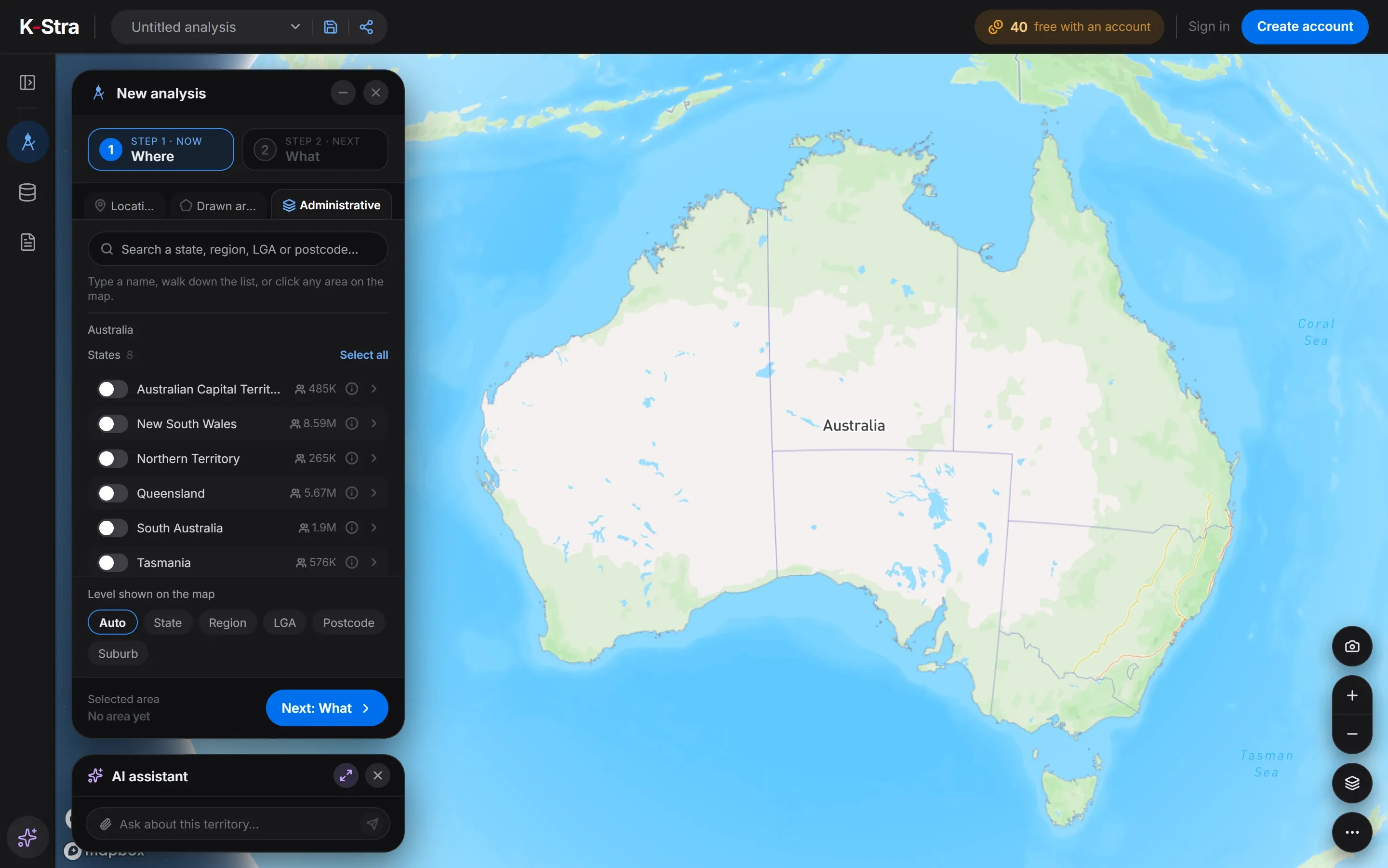 No account needed
The Where step has three ways to set an area: a location with drive or walk times, a shape drawn on the map, or administrative areas. The third lists every state with its residents and lets you walk down level by level or type a name.
Clicking the name of a council on the map opens its free dashboard. Picking areas, browsing them and reading their dashboards costs nothing; credits are spent only when an analysis runs on them.
Why does K-Stra count addresses instead of areas?
A drive time never follows official boundaries. Of the 14.5 million address points, 8.9 million have residents; each carries its share of the area’s population, so a catchment adds up exactly the addresses it reaches and its edge falls between two street numbers.
Travel times come from a road network rebuilt on 12 October 2026: by car, by car avoiding motorways, or on foot, in average or heavy traffic. Each address is attached to the nearest road it can be reached from, so a house across a river is not counted as next door.
| Variable | Source | Reference period | Measured at |
|---|---|---|---|
| Nine administrative levels, from Australia to SA1 areasWhere | ABS statistical geography | Edition 3 (2021); councils of 2025 | Area |
| 14.5 million address points, 8.9 million of them inhabitedEvery analysis | K-Stra map data · ABS population estimates | Territory version 10, 19 October 2026 | Address |
| Housing capacity of each address, from the road network and building sizeEvery analysis | K-Stra map data · K-Stra model | Territory version 10, 19 October 2026 | Address |
| Road network and travel times by car, by car avoiding motorways and on foot, in average or heavy trafficWhere | K-Stra map data · K-Stra model | Road graph of 12 October 2026 | Road segment |
| Vehicles a day on every road, both directions, in seven bands; official counts shown as measuredTraffic & Footfall | K-Stra model · Official counts | Average day of the year, or a day, range, month or hours you choose | Road segment |
| Pedestrian footfall in five grades on streets, footpaths and pedestrian ways; counters shown as measuredTraffic & Footfall | K-Stra model · Official counts | Average day of the year, or a day, range, month or hours you choose | Road segment |
Territory version 10, in production since 19 October 2026.
What changes with the new ABS geography?
Every five years the ABS redraws its statistical areas to follow population growth. Edition 4, for 2026 to 2031, came out in July 2026 for the main areas and in October 2026 for councils, postal areas and suburbs.
Most of the change is in the smallest areas, where new suburbs have filled up: 1,640 more SA1 areas and 98 more SA2 areas. K-Stra keeps Edition 3 until the 2026 Census is published on the new areas, so that boundaries and census figures stay matched.
| Areas | Edition 3 (2021) | Edition 4 (2026) |
|---|---|---|
| SA1 | 61,844 | 63,484 |
| SA2 | 2,472 | 2,570 |
| SA3 | 358 | 366 |
| SA4 | 107 | 107 |
| Postal areas | 2,643 | 2,644 |
| Suburbs and localities | 15,352 | 15,376 |
| Source | Edition in K-Stra | Published | Next update of the source |
|---|---|---|---|
| ABS Australian Statistical Geography Standard | Edition 3 (2021); councils of 2025 | 20 July 2021 | Newer edition outEdition 4 came out between July and October 2026. K-Stra moves to it with the 2026 Census, from June 2027, because 2021 Census data exist only on Edition 3 |
| K-Stra map data: addresses, buildings and roads | Version loaded on 2 October 2026 | 2 October 2026 | With the next road network update; no date set |
| Official traffic counts and pedestrian counters of state road agencies and councils | Loaded for Traffic & Footfall, in production from 4 November 2026 | Various years: each count is shown with its own | As the agencies publish new counts |
What else do people ask about areas and maps?
Why does K-Stra still use the 2021 statistical areas?
Because the 2021 Census data exist only on the 2021 areas. The ABS released Edition 4 of its geography between July and October 2026; K-Stra moves to it with the first results of the 2026 Census, from June 2027, so that areas and figures stay matched.
Are postcodes the same as postal areas?
Nearly. The ABS builds postal areas from small blocks to approximate the postcodes of Australia Post, and a few cross state borders. K-Stra uses the ABS postal areas, so figures can be checked against ABS tables.
How many areas can one analysis cover?
Up to 12 administrative areas of any level, mixed as you like, or up to 10 shapes drawn on the map. Drive-time and walk-time areas count the address points they reach, whatever the boundaries.
Pick any area
of Australia.
Search a council, a postcode or a suburb, or draw a drive time from an address.
Open the app — free to exploreBrowsing areas is free